Molly does Kineo
Since Monday was a beautiful fall day, but the weather forecast for Tuesday was much, much worse, I decided to run a day earlier than my usual schedule. And since there was ample time, I also decided that I should take Molly (my brother’s red German shepherd) up a local peak she hadn’t climbed before—even if I had. So, with the Honda back in operation (and gas in the tank), we drove up to the
After following the rugged Seven Bridges Trail up North Cheyenne Cañon almost to Jones Park, the route then leaves the trail on the west side of the mountain. From there, it’s several hundred vertical feet of bushwhacking up the ridge, on the north side of the crest. I don’t think I’ve ever followed exactly the same route twice. There are two or three rocky ridge points which can be either scaled or bypassed along the way, plus a little bit of scrambling through talus. Once the first major ridge point is gained, sections of half-decent climber’s trail can be followed to a point on the north side of the summit block.
As I’ve come to expect, Molly did just fine staying with me through the rocks, even in the one brief section where it gets a bit steep. We clambered up the last few feet to the summit one hour and one minute after leaving the trailhead, just about 2,000 feet below. We had only seen one other person along the way (and he had his dog with him, too).
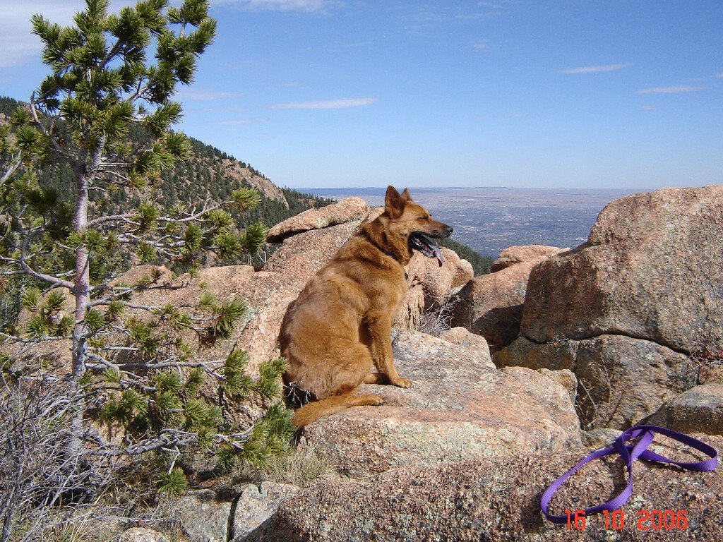
The weather held clear and mostly windless. Even on the relatively exposed summit, I was comfortable in running shorts, without the gloves or earband I had brought, although I did wear long sleeves the whole way. I snapped a couple of pictures of Molly on the summit, bailed on trying a shutter-delay picture of myself for lack of a decent place to set the camera, and, after five minutes on the top, headed down.
Not far below the summit, there is a place where the trees open up, and I took advantage of it to get some pictures looking north, showing Pikes Peak (you can see the building on the summit), Mt. Garfield, Mt. Arthur, and Tenney Crags (all much closer!). Snow has fallen here, but I found nothing left of it up to 9,500 feet—actually, as I could see clearly, up to significantly higher altitudes. But “the Peak” carries a mantle of white which will, no doubt, last until spring.
The trip down was uneventful, although we did pass two or three parties of hikers on the trail. Still, there was mostly solitude. We got back to the parking lot in 47 minutes, close to my best time.
Pictures are posted at:
http://new.photos.yahoo.com/cftbq/album/576460762325246212#page1
Now, I’ll sign the SummitPost climbers’ log for Kineo yet again, and plan for other relatively low summits, while dreaming of higher peaks yet to come.
posted by cftbq at 5:35 PM
![]()


0 Comments:
Post a Comment
<< Home